Live Tides
NOTICES TO MARINERS
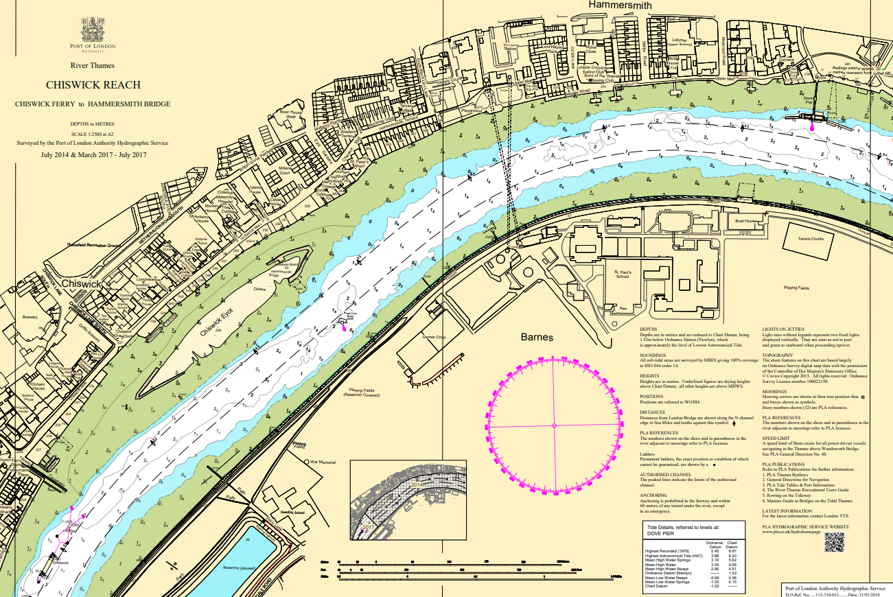
Charts & Surveys
Incident reporting
Life-threatening emergencies on the river:
Call 999 and ask for the Coastguard
For near miss, safety observations and incident reporting click below
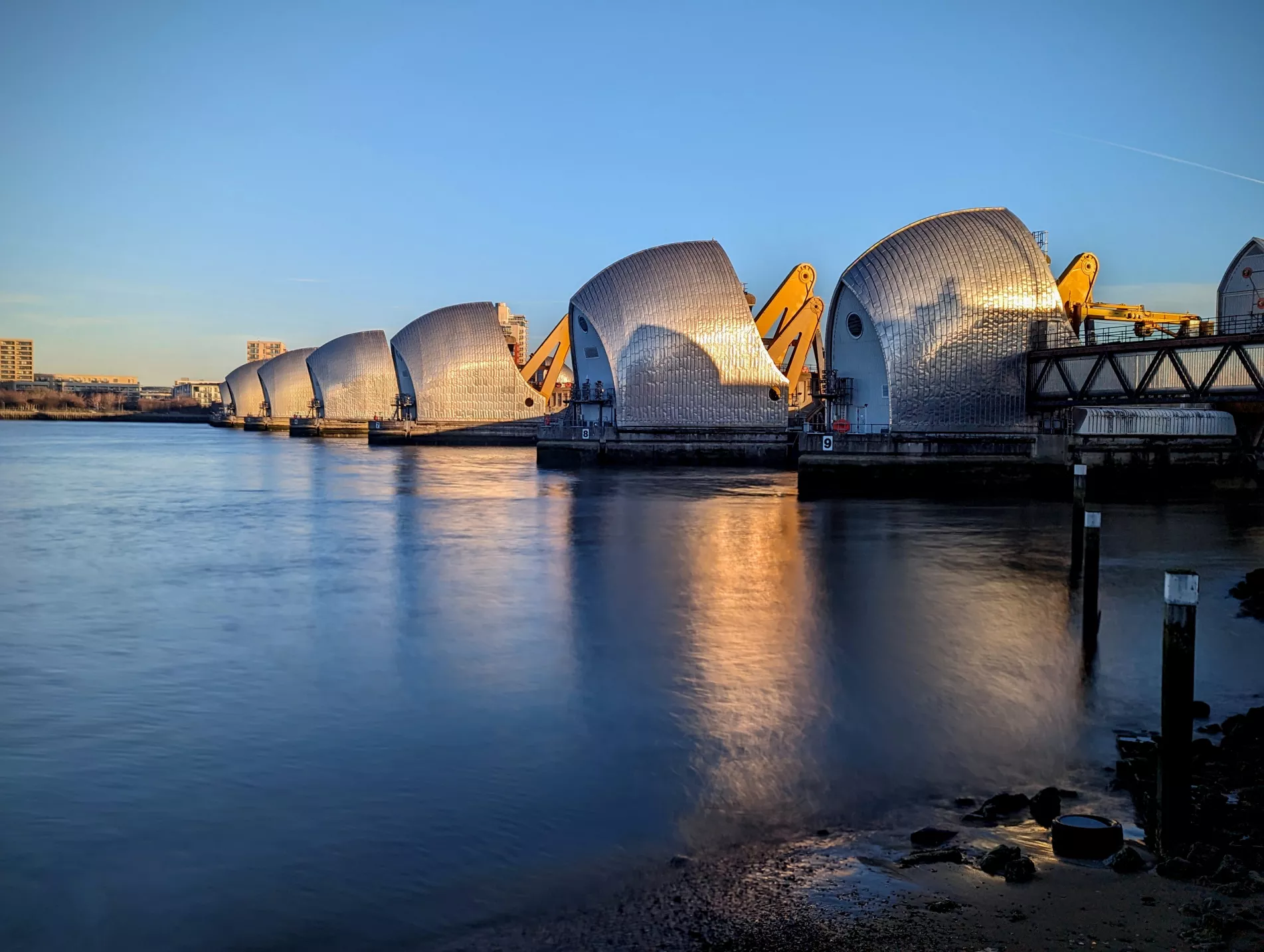
Navigating the Thames Barrier
Key information for travelling through or near the iconic structure
The iconic Thames Barrier, managed by the Environment Agency, has been keeping London protected from flooding since it became operational in 1982.
Here's what you need to know for your next passage on the eastern tidal Thames.
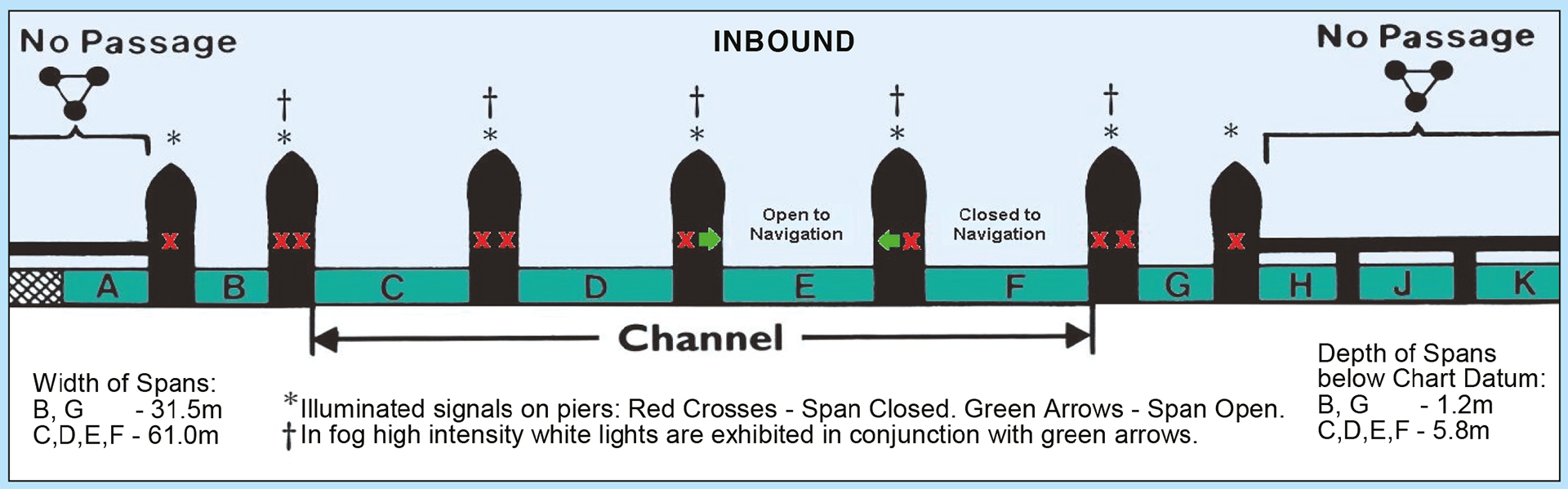
The Thames Barrier has ten spans lettered A to K from south to north:
- Spans B to G are open to navigation subject to the restrictions described in current General Directions.
- Spans C, D, E and F are 61m wide with a depth of 5.8m below Chart Datum.
- Spans B and G are 31.5m wide with a depth of 1.2m below Chart Datum and have depth boards on Piers 3 and 9.
- Spans A, H, J and K are permanently closed to navigation. Under normal circumstances, and subject to the requirements of partial closures, the northern spans E, F and G are used for inward bound traffic and the southern spans B, C, and D are used for outward-bound traffic.
(The piers of the barrier are numbered 1 to 9, from north to south. There are signs indicating the number of the pier on both east and west sides of the barrier.)
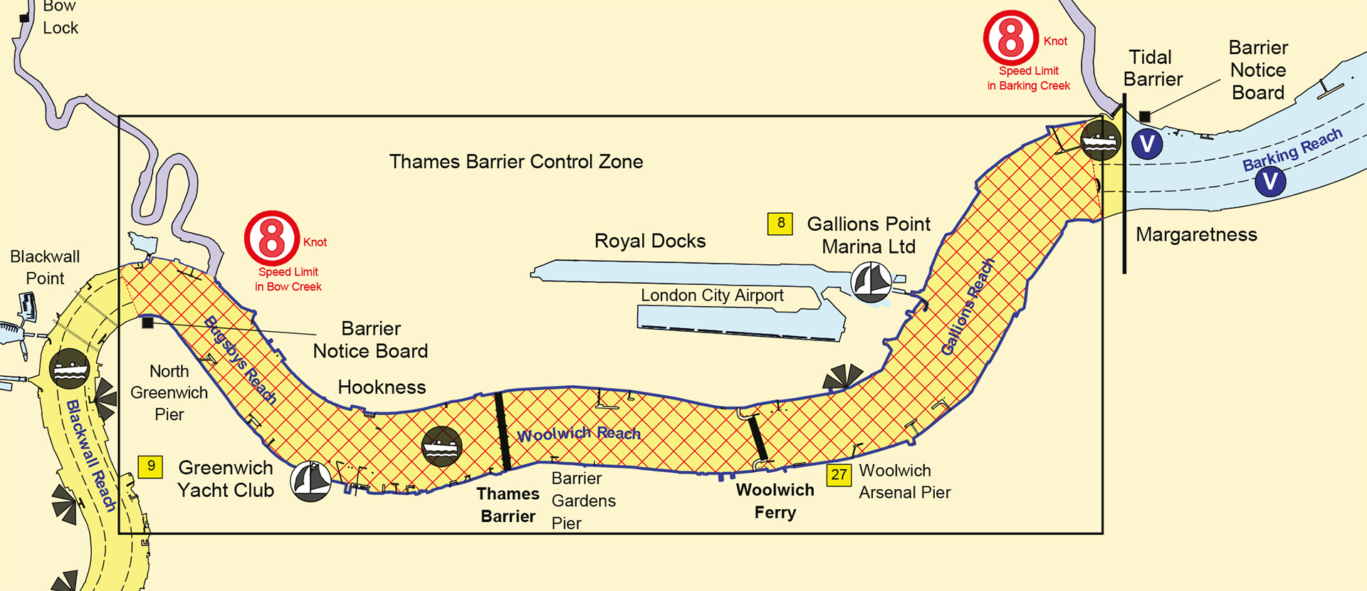
Thames Barrier Control Zone
A permanent Control Zone encompassing the Thames Barrier is established between Margaretness (next to the entrance to Barking Creek) and Blackwall Point (at the O2 Dome).
Usually, traffic is routed through one span in each direction, which will be indicated by green arrows. Spans which are closed to navigation will be indicated by red crosses on the piers of the Barrier.
*Do not navigate through a span which is closed to navigation – the gates may be under the water or rotating to a defence position*.
Vessels intending to pass through the Barrier should contact London VTS on VHF Channel 14 at either Margaretness Inward bound or Blackwall Point Outward bound. London VTS will then allocate a span which will be indicated as being available by the green arrows.
Occasionally, all the spans at the Thames Barrier may be closed either for test purposes or because of a predicted tidal surge (the Environment Agency publishes a list of test closures in advance. See either the PLA Notice to Mariners or the EA’s website). When this is the case, you should remain clear and not enter the Thames Barrier Control Zone due to the unpredictable eddies and currents that are produced.
Spans Open to Navigation
Light Signals
Each navigational span of the Barrier has traffic signals on the ends of the adjacent piers to indicate whether the spans are open or closed to navigation. Spans are only ever open to traffic in one direction at a time.
Green Arrows will be shown from the ends of piers either side of a span(s) open to navigation. The arrows point inwards towards the span open to navigation. Red crosses will be shown from the ends of the piers either side of span(s) which are closed to navigation.
Spans Permanently Closed to Navigation
Span A (the southern most span) and spans H, J and K (the northern most spans) are permanently closed to navigation and display closure signs which are also used on closed bridge arched (3 red discs in an inverted triangle)
Overtaking and Manoeuvring Restrictions
Any vessel wishing to overtake another vessel, or any vessel wishing to carry out manoeuvres in the Thames Barrier Control Zone, may only do so with the express permission of the Harbourmaster at London VTS.
Vessels Under Sail
Vessels proceeding under sail between the Woolwich Ferry Terminal and Hookness must keep to the starboard side of the fairway and are not to impede any other vessels. Whenever possible, such vessels should take in their sails and use motor power to navigate through the Thames Barrier.
Small Vessels (under 13.7 metres in length)
All small vessels and craft such as yachts, dinghies, power boats, sculls, rowing boats and canoes not fitted with VHF radio are to navigate inwards through the northern most span and outwards through the southern most span which is open to navigation (indicated by green arrows) and which has sufficient depth of water.
Further detailed information about navigation through the Thames Barrier is included within the General Directions for Navigation in the Port of London.