Live Tides
NOTICES TO MARINERS
Charts & Surveys
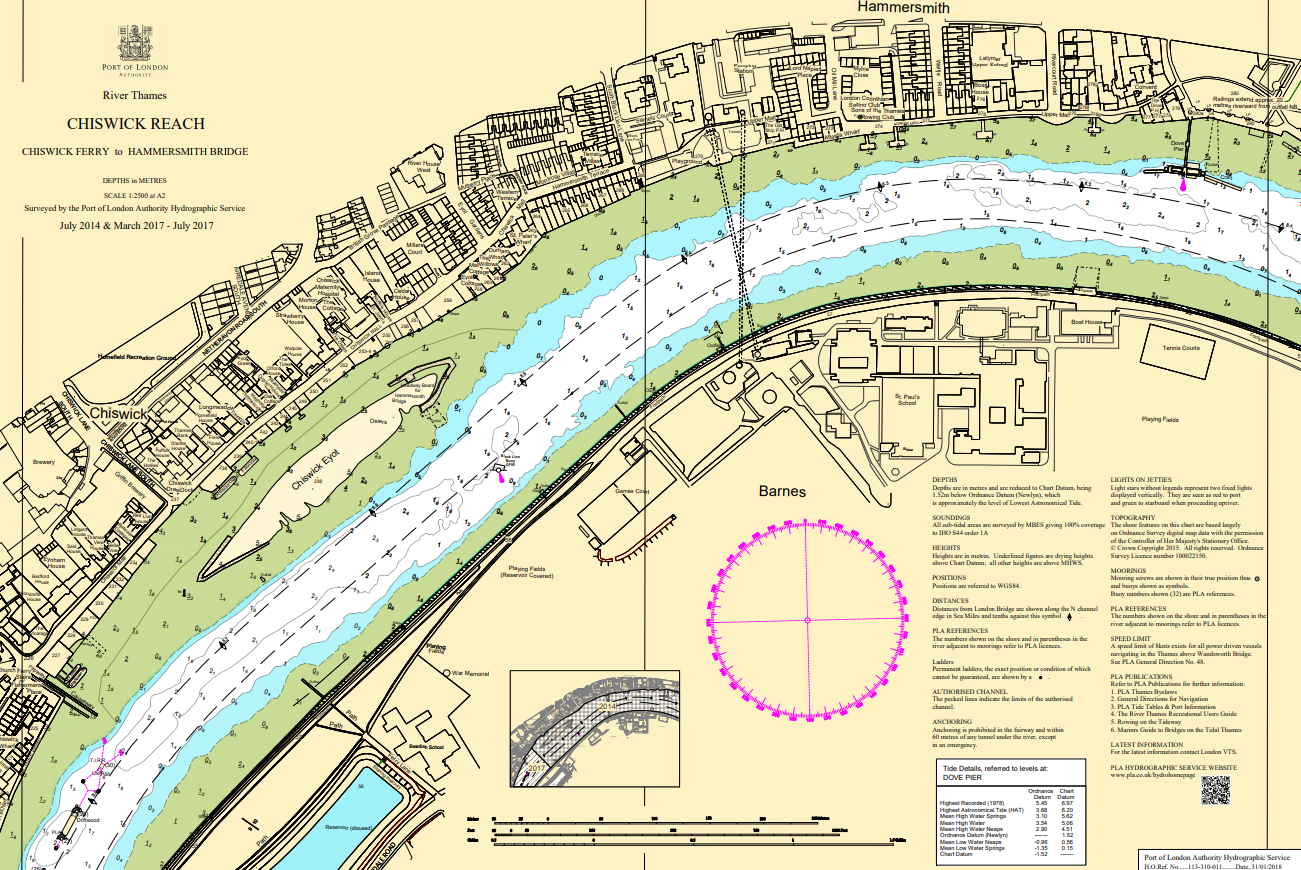
Hydrographic charts, surveys and miniplots are available online from our GIS system
Incident reporting
Life-threatening emergencies on the river:
Call 999 and ask for the Coastguard
For near miss, safety observations and incident reporting click below
Thames bridge heights
Thames Bridge Clearances
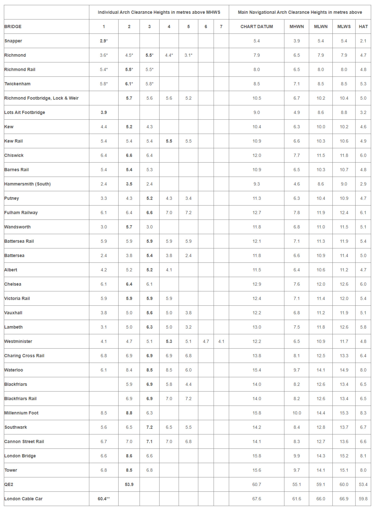
Clearance Heights identified in BOLD refer to the main navigational arch.
* Refers to headway above maintained water level.
** Refers to minimum clearance to bottom of cable car gondolas, when loaded and at the bottom of the catenary.
Arches are numbered from the north shore to south shore.
Further information on all the bridges can be found in the PLA "Mariners' Guide to Bridges on the Tidal Thames".
Headway Boards
Headway boards are provided at Hammersmith. Click here for details.
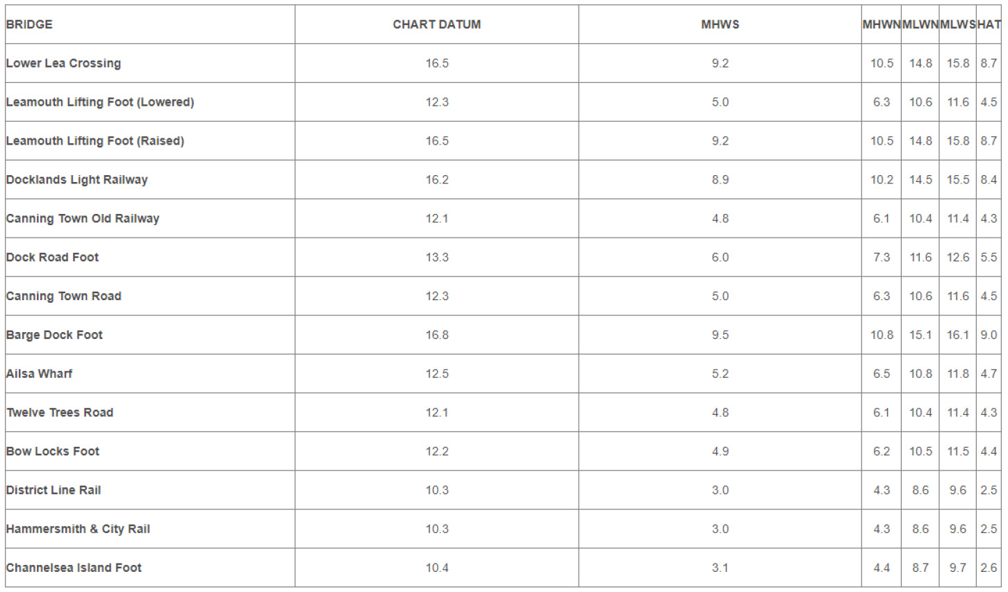
Bow Creek Bridge Clearances
Minimum Headway of NAVIGABLE ARCH in METRES above:
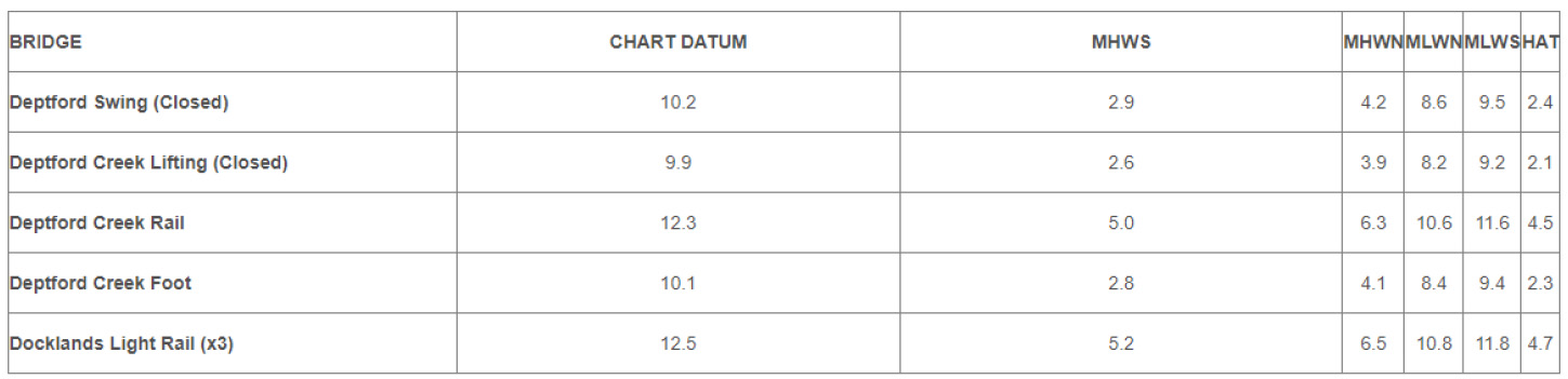
Deptford Creek Bridges Clearances
Minimum Headway of NAVIGABLE ARCH in METRES above: