Live Tides
NOTICES TO MARINERS
Charts & Surveys
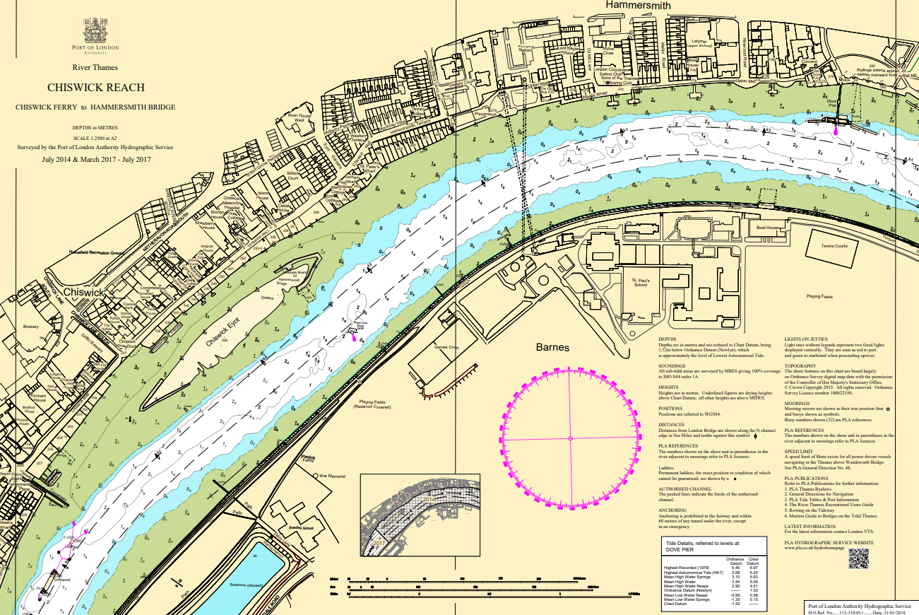
Hydrographic charts, surveys and miniplots are available online from our GIS system
Incident reporting
Life-threatening emergencies on the river:
Call 999 and ask for the Coastguard
For near miss, safety observations and incident reporting click below
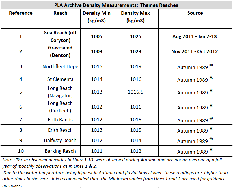
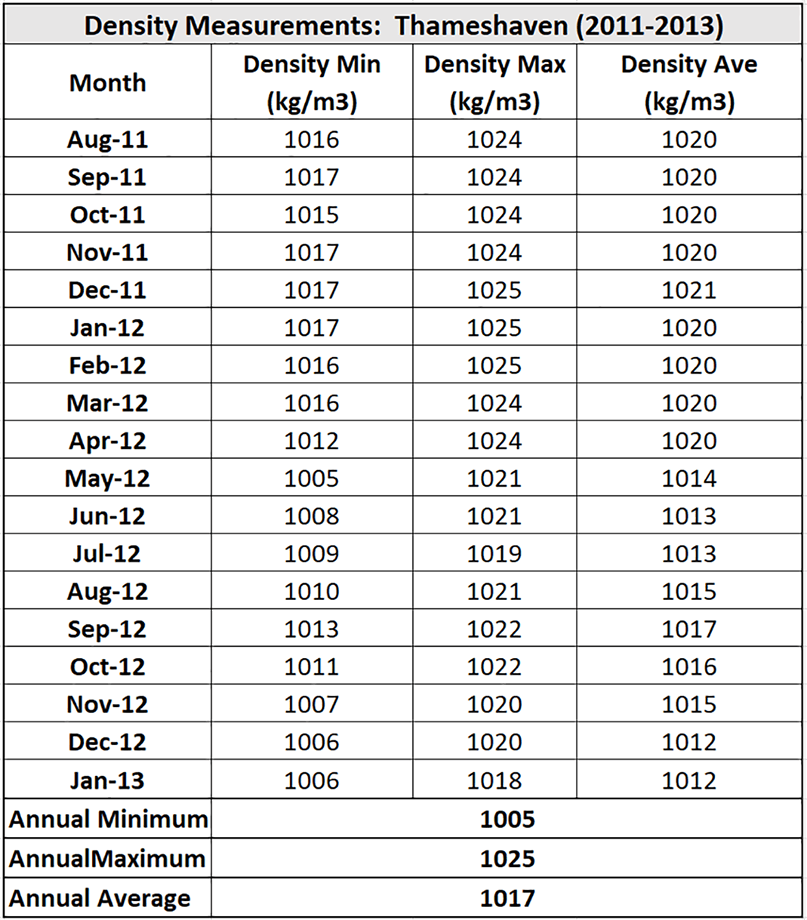
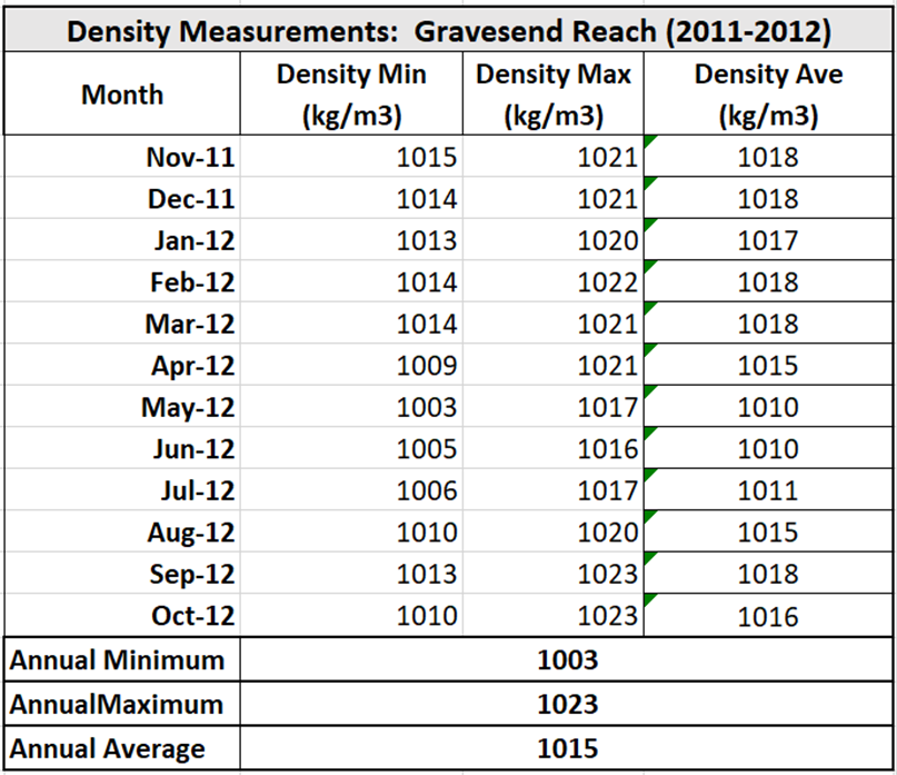
Water density readings
The tables below show observed water density readings held by the Port of London Authority (PLA) and are provided to serve as a guide only for water densities that may be encountered on the Thames.
The PLA accepts no responsibility as to their accuracy.
Density measurements vary temporally throughout the day and year and are significantly affected by local variations in salinity and temperature.
It is recommended that for density values to be used for draft or freshwater allowance calculations, that in situ measurements taken at the location of the vessel or terminal.