Live Tides
NOTICES TO MARINERS
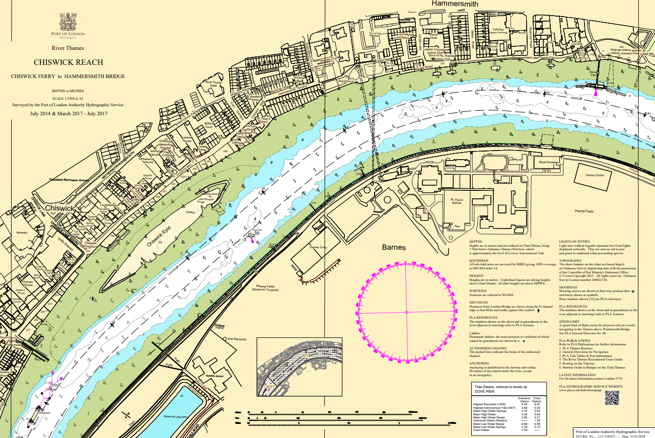
Charts & Surveys
Incident reporting
Life-threatening emergencies on the river:
Call 999 and ask for the Coastguard
For near miss, safety observations and incident reporting click below
Case Study: C.Ro berth survey
Our in-house drone survey capacity can provide support for a variety of projects and present the data in a variety of outputs.
As part of a licensing requirement, C.Ro needed to survey the area surrounding their berth, including some shallow mud floats. The problem was that the mud flats were too shallow to survey economically with a multibeam echo sounder, due to the vey narrow tidal window when there was enough water over the area, and also that due to the shallow depths a MBES system could only survey a narrow swath.
The solution that the PLA provided was to survey the area with an aerial drone using photogrammetry. This is a technique whereby the drone takes thousands of photos as it fly a grid over the area. These photos can then be merged using specialist software to create a 3D model. We are able to generate the 3D model from the 2D photos because of the range of angles we take the photographs from. We also place control points on the land to enable the model to georeferenced.
This is an ideal solution for surveying shallow intertidal areas.