Live Tides
NOTICES TO MARINERS
Charts & Surveys
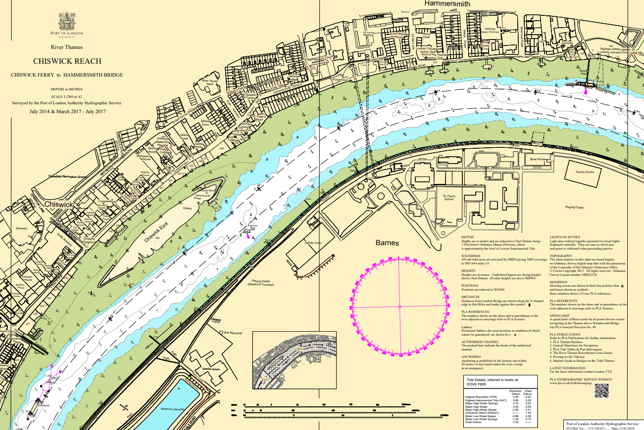
Hydrographic charts, surveys and miniplots are available online from our GIS system
Incident reporting
Life-threatening emergencies on the river:
Call 999 and ask for the Coastguard
For near miss, safety observations and incident reporting click below
Support for civil engineering
Need support for a project?
+
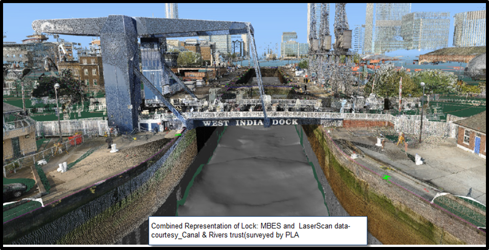
Integrated survey solutions
Need a survey of under water and surface combined?
PLA can acquire both bathymetric data, surface laser data, and photographic and combine them into a single seamless point cloud.
Benefits:
- All survey data in one place
- Easy to extract measurements
Deliverables:
- full xyz point cloud
- decimated xyz point cloud
- Fledermaus scene file
+
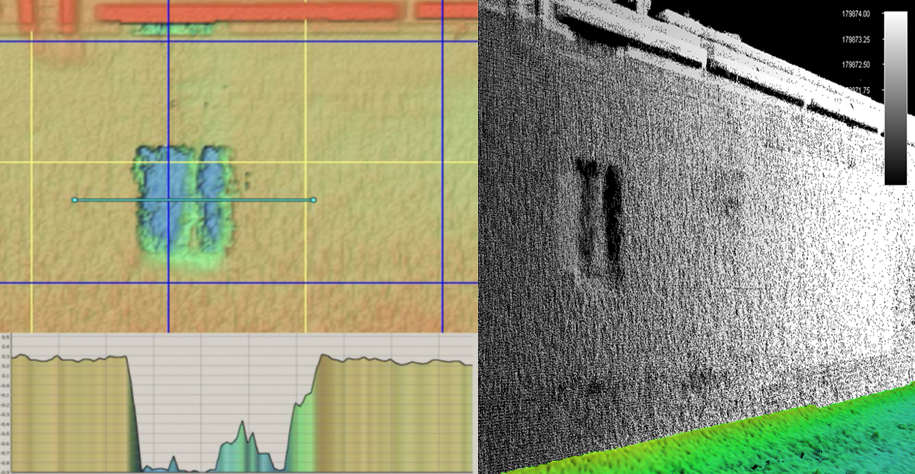
Wall survey
The PLA can acquire both bathymetric data of river and dock walls.
Benefits:
- Easy to take measurements from the data
- Can identify defects
- Historic record in case of any future damage
- Can reduce diver time and focus attention to defects
Deliverables:
- Full xyz point cloud
- Decimated xyz point cloud
- Fledermaus scene file
- Report
+
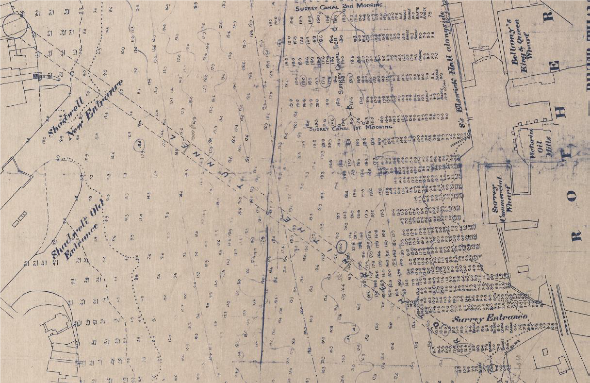
Historic data
Need historic river records?
The PLA hold chart data (and other data sets) going back to early 1900s.
Benefits:
- Know the site history
- Know the changes occurring over time
- Reduce the risk of surprises during construction
Deliverables:
- PDF files
- Partially digitised-georeferenced
- Fully digitised with soundings extracted
+
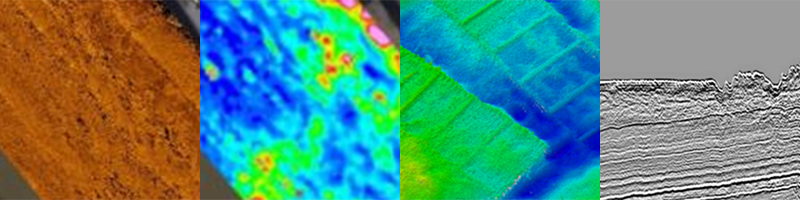
UXO survey suite
Need a UXO survey prior to works?
The PLA can acquire a suite of surveys to provide a comprehensive UXO survey package, for example:
- Gradiometer survey
- Sidescan survey
- MBES survey
- GeoChirp 3D survey
Benefits
- Reduced risk of unexpected UXO
- Reduced risk of delays
- Valuable data set that can be leveraged for other uses
Deliverables
- Listing of Potential Contacts, XYZ
- Target Characterisation Sheets
- Geotiff of GeoChirp 3D Coverage
- Survey report