Live Tides
NOTICES TO MARINERS
Charts & Surveys
Hydrographic charts, surveys and miniplots are available online from our GIS system
Incident reporting
Life-threatening emergencies on the river:
Call 999 and ask for the Coastguard
For near miss, safety observations and incident reporting click below
UXO survey suite
Need a UXO survey?
+
Need a UXO survey prior to works?
The PLA can acquire a suite of surveys to provide a comprehensive UXO survey package, for example:
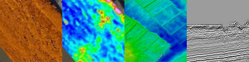
- Gradiometer survey
- Sidescan survey
- MBES survey
- GeoChirp 3D survey
Benefits:
- Reduced risk of unexpected UXO
- Reduced risk of delays
- Valuable data set that can be leveraged for other uses
Deliverables:
- Listing of Potential Contacts, XYZ
- Target Characterisation Sheets
- Geotiff of GeoChirp 3D Coverage
- Survey report
+
Need to detect ferrous objects?
The PLA can acquire gradiometer surveys.
Benefits:
- Identification of ferrous objects, which could affect future works
- Georeferenced
- Data can be cross correlated with other surveys
Deliverables:
- Report
- Gradiometer geotiff
- Excel list of ferrous anomalies
+
Need to detect surface objects?
The PLA can acquire sidescan surveys
Benefits:
- Detects objects not readily imaged by other means
Deliverables:
- Report
- Sidescan geotiff
- Excel list of surface contacts
+
Backscatter surveys
The PLA can acquire backscatter surveys.
Benefits:
- Data georeferenced, so it can be integrated with MBES data
- Can be acquired during a MBES survey
- Can be used to model surface composition, eliminating or reducing the need for grab samples
Deliverables:
- Report
- Sidescan geotiff
- Excel list of surface contacts
+
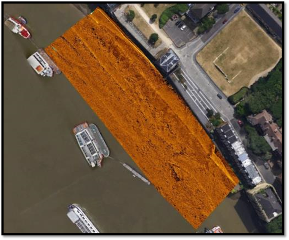
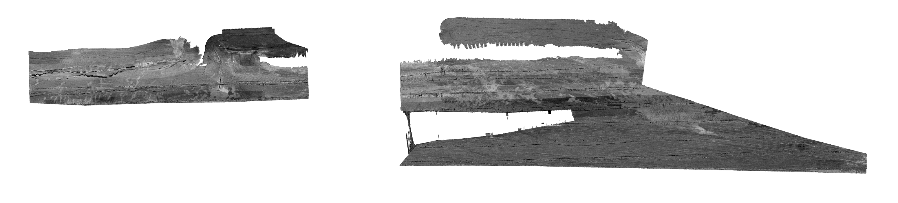
GeoChirp 3D surveys
Need high resolution image of the sub-surface (<10m)?
The PLA can acquire a 3D CHIRP Survey.
Benefits:
- A subsurface image with 12.5 (or 25cm) horizontal resolution
- The acquisition of GeoChirp 3D data will open opens up for extraction of geophysical properties, object detections
Deliverables:
- Report
- Geotiff of GeoChirp 3D Coverage
- Processed 3D SEG-Y files (NMO and migrated)
+
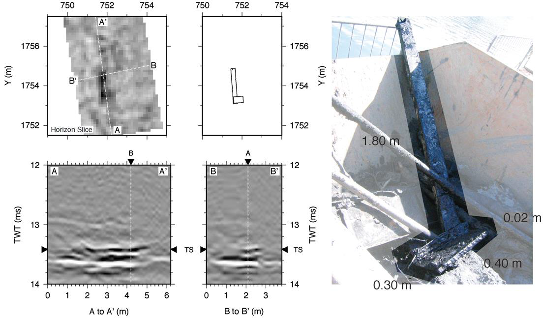
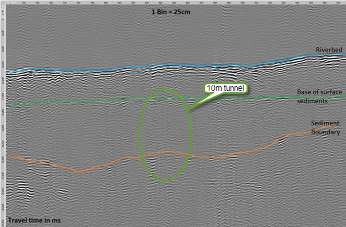
Subsurface object detection
Need to detect objects in the subsurface?
The PLA can process the GeoChirp 3D data to characterise subsurface objects.
Benefits:
- Subsurface objects accurately positioned
- Subsurface objects dimensioned
Deliverables:
- Report
- Listing of Potential Contacts, XYZ with object dimension
- Target Characterisation Sheets